Map
Detailed Information
- Place Types Church
- Address 32500 Akpınar/Eğirdir/Isparta, Turkey
- Coordinate 37.844962,30.833866
- Website Unknown
- Rating 2.5
- Compound Code RRVM+XG Akpınar, Eğirdir/Isparta, Turkey
Photos
Reviews

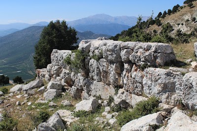
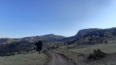
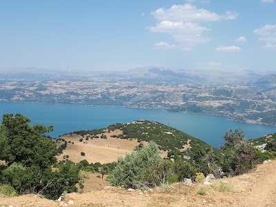
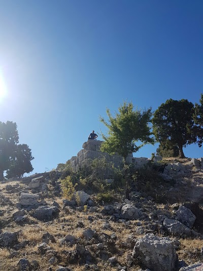
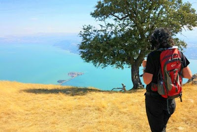
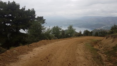
Here’s the trick to find it, after the pin where Google says it is keep going on the dirt road for another maybe 500m. The ruins are right at the base of the mountain peak with the Turkish flag on top. They are underneath an electric power tower. There is a sign post. It still might take some exploring on the roads to find it, I found it by accident. Ruins are ok, but view is worth it, and you can scramble up the top of the mountain if you can handle a steep technical (but not dangerous) hike. Took me ~1 hour to the top.

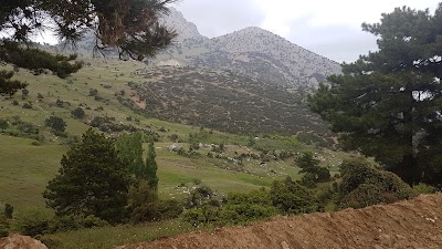
Well I'm standing exactly on the spot shown on Google maps and there's no ancient city here. A sign 100m up the track points in the opposite direction. Apparently somewhere on a 'saddle' of land you can just about see the remains of an acropolis and boundary wall. Nevertheless a pleasant walk and the views are nice. Better luck to others that try and find this ancient city.
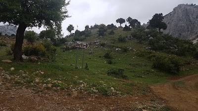
Footnote :- a couple staying in my hotel told me that they carried on walking for another 30-40 minutes after the location shown on Google maps following the track until they reached some farm equipment. Above that was the ruins.

Very nice

The way to go is really bad and very far. We had to turn around half way.

We entered the military while finding the way.
Similar place
Şerefiye, S. Mehmet Efendi Sk. 27a, 65140 Van Merkez/Van, Turkey
Unknown
Unknown
Seyit Fehim Arvasi, Cumhuriyet Cd. No:77, 65100 Van Merkez/Van, Turkey
+90 432 216 75 40
Unknown
Şerefiye, 65100 Van Merkez/Van, Turkey
Unknown
http://www.bosch.com.tr/
Alipaşa, Şakir Hoca Sk. No:3, 65130 Van Merkez/Van, Turkey
Unknown
Unknown
yorulmazlar balık lokantası, Kayaardı, 64502 Gürlek/Banaz/Uşak, Turkey
Unknown
Unknown
Şair İbrahim Rafet, Gülabibey 5. Sk. No:1, 63600 Siverek/Şanlıurfa, Turkey
Unknown
Unknown
Güney mah, 14 sokak No: 12/b, 63600 Siverek/Şanlıurfa, Turkey
+90 414 553 27 07
http://www.akciceksigorta.com/
Fırat, Fırat 9. Sk. No:9, 63600 Siverek/Şanlıurfa, Turkey
+90 532 664 16 64
Unknown
Eski Diyarbakır Caddesi Topçu Alayı Karşısı Hikmet Apartman Altı No: 34, Ofis, 63600 Siverek/Şanlıurfa, Turkey
+90 414 553 23 23
http://sevvalocakbasi.com/
Hasan Çelebi, Mah. 52. Sok No: 5, 63600 Siverek/Şanlıurfa, Turkey
+90 414 552 94 94
https://www.osmanli-sofrasi.com.tr/
Kale, Seyfioğlu Cd. No:8, 63600 Siverek/Şanlıurfa, Turkey
+90 535 775 16 60
Unknown
Camikebir, Cudi Paşa Cd. no 8 b, 63600 Siverek/Şanlıurfa, Turkey
+90 538 818 03 63
Unknown
Pınarönü, Dar Çarşı Sk D:no.4, 58400 Şarkışla/Sivas, Turkey
+90 544 552 20 50
Unknown
Kayalıyokuş, Gebze Hali Sk., 58400 Şarkışla/Sivas, Turkey
+90 542 821 58 26
http://youtube.com/
Kayalıyokuş, 58400 Şarkışla/Sivas, Turkey
Unknown
Unknown
Gültepe, Sanayi Sitesi, 72070 Yediyol/Batman Merkez/Batman, Turkey
Unknown
Unknown
Tepe, Kordon Cd. No:2, 48700 Marmaris/Muğla, Turkey
Unknown
Unknown