Map
Detailed Information
- Place Types Tourist attraction
- Address Lewes, DE, USA
- Coordinate 38.8144824,-75.0923667
- Website http://delawarebaylights.org/OurLights.html
- Rating 4.7
- Compound Code RW75+Q3 Lewes, DE, USA
Photos

Reviews

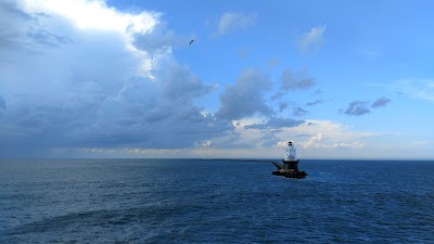
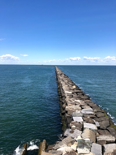
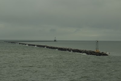
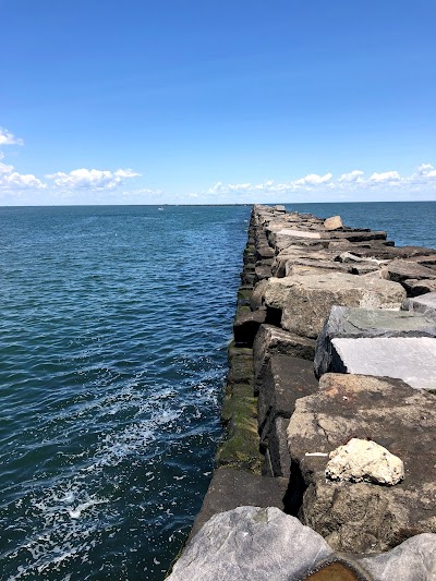
In fact he autumn of 2004 i was making a passage from the Atlantic Highlands to the mouth of the Chesapeake. The weather report was good and we set off going around Sandy Hook and headed down the New Jersey coast in our 58 foot sailboat. The weather gradually turn pretty foul with a strong east wind and night had approached. The sail on and it tough. I knew i had to get to shelter. The inlet at the Coast Guard station was a possibility but there is little room to anchor. Then i noticed on the charts the Lewes point and the light louse, but it also showed a long high break water, about 20 feet in height. So as day break began i headed for the small passage way between the light house and Lewes point. We drafted 7 feet with our keel so the deep channel was very narrow.nWhen i made the turn, the wind was now out of the northeast and the wall was a great barrier. Wow what luck. But there was a problem. There was a large Coast Guard ship hiding behind the wall and at that time no boat was allowed to come within 100 yards of a military ship.ni hailed the Coast Guard ship and asked for permission to anchor since the storm was really bad. The captain was really great and said i could anchor but i had to be careful since he had 200 feet of anchor rode out. I acknowledged and set my anchor. The using radar and my Gps plotter i stood watch and watched the boat turn with the wind. Our anchor held! The next morning the Coast Guard ship was gone but the wind and the waves were terrible.nWell in a period of 8 days we rode out 4 storms behind that wall and lighthouse. Finally the weather broke and my wife did want not want to go back out and down the coast to the Chesapeake. So we took the canal into the Chesapeake and worked our way down to Virginia - little creek.nThat stone wall was built to harbor big freighters as they navigated the Delaware River. It is shallow and storms create huge waves and the shoals move about.nI will never forget sitting out those 8 days and all the anchor watches.nAnd finally i heard a scallop boat that was fishing lose a man overboard. They searched for hours, but to no avail. The ocean is not kind, it is the ocean.

Very wet but fishing is great

When we were on the Cape May-Lewes ferry we saw a big school of Dolphins feeding and playing right a the base of the lighthouse! It was really cool. My kids loved it!

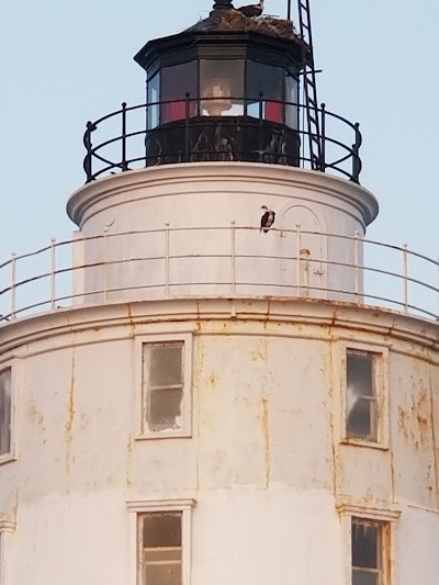
Beautiful and well maintained light house. Tours are infrequent and with only like 20 people at a time. Worth the money for the experience and it helps the refurbishment of the lighthouse itself. Will see tons of dolphins as well.

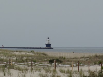
This lighthouse is not visible from land as the adjacent beach is closed for protected wildlife (birds). Take one of the lighthouse tour boats instead.
Similar place
1833 8th St NW, Albuquerque, NM 87102, USA
+1 505-246-2926
https://sf2926.business.site/
2401 12th St NW, Albuquerque, NM 87104, USA
+1 505-843-7270
http://indianpueblo.org/
323 Marble Ave NW, Albuquerque, NM 87102, USA
Unknown
https://www.nps.gov/nr/travel/route66/madonna_of_the_trail_albu
Metropolitan Courthouse, Albuquerque, NM 87102, USA
Unknown
Unknown
1701 Mountain Rd NW, Albuquerque, NM 87104, USA
+1 505-224-8300
http://www.explora.us/
1801 Mountain Rd NW, Albuquerque, NM 87104, USA
+1 505-841-2800
http://www.nmnaturalhistory.org/
2000 Mountain Rd NW, Albuquerque, NM 87104, USA
+1 505-243-7255
http://www.cabq.gov/museum
330 Tijeras Ave NW suite q, Albuquerque, NM 87102, USA
+1 505-200-2642
http://tourabq.com/
330 Tijeras Ave NW, Albuquerque, NM 87102, USA
+1 505-200-2642
http://www.tourabq.com/
201 3rd St NW ste q, Albuquerque, NM 87102, USA
+1 505-200-2642
http://www.tourabq.com/dukecitypedaler
615 Rio Grande Blvd NW, Albuquerque, NM 87104, USA
+1 505-842-0589
Unknown
110 4th St NW, Albuquerque, NM 87102, USA
+1 505-842-2937
http://telephone-museum.poi.place/
Plaza don Luis, 303 Romero St NW N120, Albuquerque, NM 87104, USA
+1 505-246-8687
https://www.abqtours.fun/
423 Central Ave NW, Albuquerque, NM 87102, USA
+1 505-768-3522
http://www.kimotickets.com/
616 Central Ave SW, Albuquerque, NM 87102, USA
+1 505-247-0606
http://www.nmholocaustmuseum.org/
2500 Central Ave SW, Albuquerque, NM 87104, USA
+1 505-361-1667
https://elvadoabq.com/
500 University Blvd NE, Albuquerque, NM 87106, USA
+1 505-277-4405
http://maxwellmuseum.unm.edu/
Albuquerque, NM 87104, USA
+1 505-768-2000
https://www.cabq.gov/culturalservices/biopark/garden/exhibits/b
CERIA, Building 83 of 87131, 302 Yale Blvd NE, Albuquerque, NM 87106, USA
+1 505-277-1360
http://www.msb.unm.edu/
1100 2nd St SW, Albuquerque, NM 87102, USA
+1 505-243-6269
http://www.wheelsmuseum.org/